The Revolution of Wearable Navigation Devices
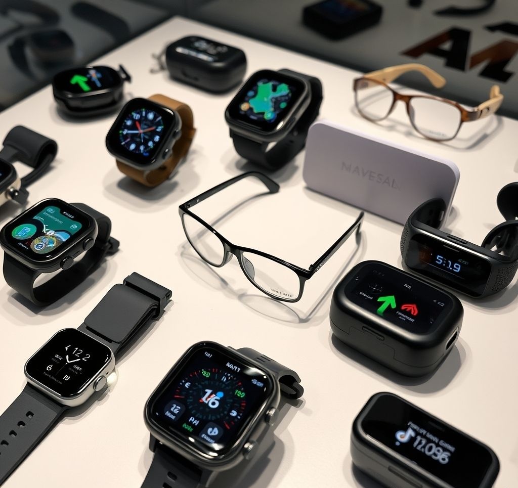
The evolution of navigation technology is moving beyond smartphones and dedicated GPS units into the realm of wearables. From smartwatches that guide your daily run to haptic belts that help the visually impaired navigate city streets, wearable navigation devices are creating new possibilities for hands-free, intuitive wayfinding. This article explores the current landscape of wearable navigation technology, evaluates leading products, and looks ahead to emerging innovations that could transform how we navigate our world.
In This Article:
Advantages of Wearable Navigation
Wearable navigation technology offers several distinct advantages over traditional navigation methods:
Hands-Free Operation
Perhaps the most significant benefit of wearable navigation devices is the ability to receive directions without holding or looking at a device. Whether you're cycling, carrying groceries, or simply want to stay more present in your environment, hands-free navigation allows you to focus on the journey rather than the device.
Enhanced Situational Awareness
By reducing screen time and integrating navigation cues more naturally into your sensory experience, wearables help maintain better awareness of your surroundings. This improved situational awareness is particularly valuable in unfamiliar or potentially hazardous environments.
Discreet Guidance
Many wearable navigation systems provide subtle cues through vibration, gentle audio prompts, or peripheral visual indicators. This discretion allows users to navigate without announcing to others that they are following directions—particularly useful in unfamiliar urban environments.
Activity-Specific Design
Unlike smartphones, which are designed as multi-purpose devices, many navigation wearables are optimized for specific activities like hiking, cycling, or urban exploration. This specialized design offers features precisely tailored to particular navigation contexts.
Continuous Connectivity
Wearable devices typically maintain constant contact with the user, unlike phones that may be stowed in pockets or bags. This persistent connection ensures navigation cues are immediately perceived, reducing the likelihood of missed turns or directions.
"The best navigation technology is the one that disappears from your conscious awareness while still guiding you effectively. Wearables get us closer to this ideal than any previous form factor."
— Dr. Maya Persson, Human-Computer Interaction Specialist
Categories of Wearable Navigation Devices
The wearable navigation landscape encompasses several distinct categories, each with unique characteristics and use cases:
Wrist-Worn Devices
Examples: Smartwatches, GPS sport watches, fitness bands with navigation features
Primary Feedback: Visual display, vibration alerts
Best For: General navigation, fitness activities, outdoor adventures
Advantages: Familiar form factor, multi-purpose functionality, good battery life
Limitations: Small screen size, limited interface complexity
Head-Mounted Displays
Examples: Smart glasses, AR headsets with navigation capabilities
Primary Feedback: Visual overlay, audio cues
Best For: Complex navigation scenarios, hands-intensive activities
Advantages: Immersive experience, detailed visual guidance, natural field of view
Limitations: Higher cost, social acceptance issues, battery constraints
Haptic Navigation Systems
Examples: Vibrating belts, vests, or wristbands that indicate direction
Primary Feedback: Tactile vibration patterns
Best For: Discreet navigation, accessibility solutions, high-attention environments
Advantages: Works without visual attention, intuitive directional sensing, discreet
Limitations: Limited information complexity, requires learning vibration patterns
Audio Navigation Wearables

Examples: Smart earbuds, bone conduction headphones with navigation features
Primary Feedback: Spoken directions, spatial audio cues
Best For: Urban navigation, accessibility applications, multitasking scenarios
Advantages: Detailed instructions possible, works with limited visual attention
Limitations: May interfere with environmental awareness, requires audio processing
Smart Apparel
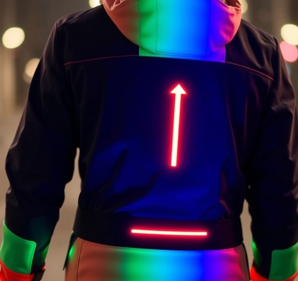
Examples: Smart jackets, shoes with embedded navigation, connected helmets
Primary Feedback: Varied (tactile, visual LEDs, subtle movements)
Best For: Specific activities (cycling, motorcycling, running)
Advantages: Seamlessly integrated into necessary gear, activity-optimized
Limitations: Limited to specific contexts, typically requires smartphone connection
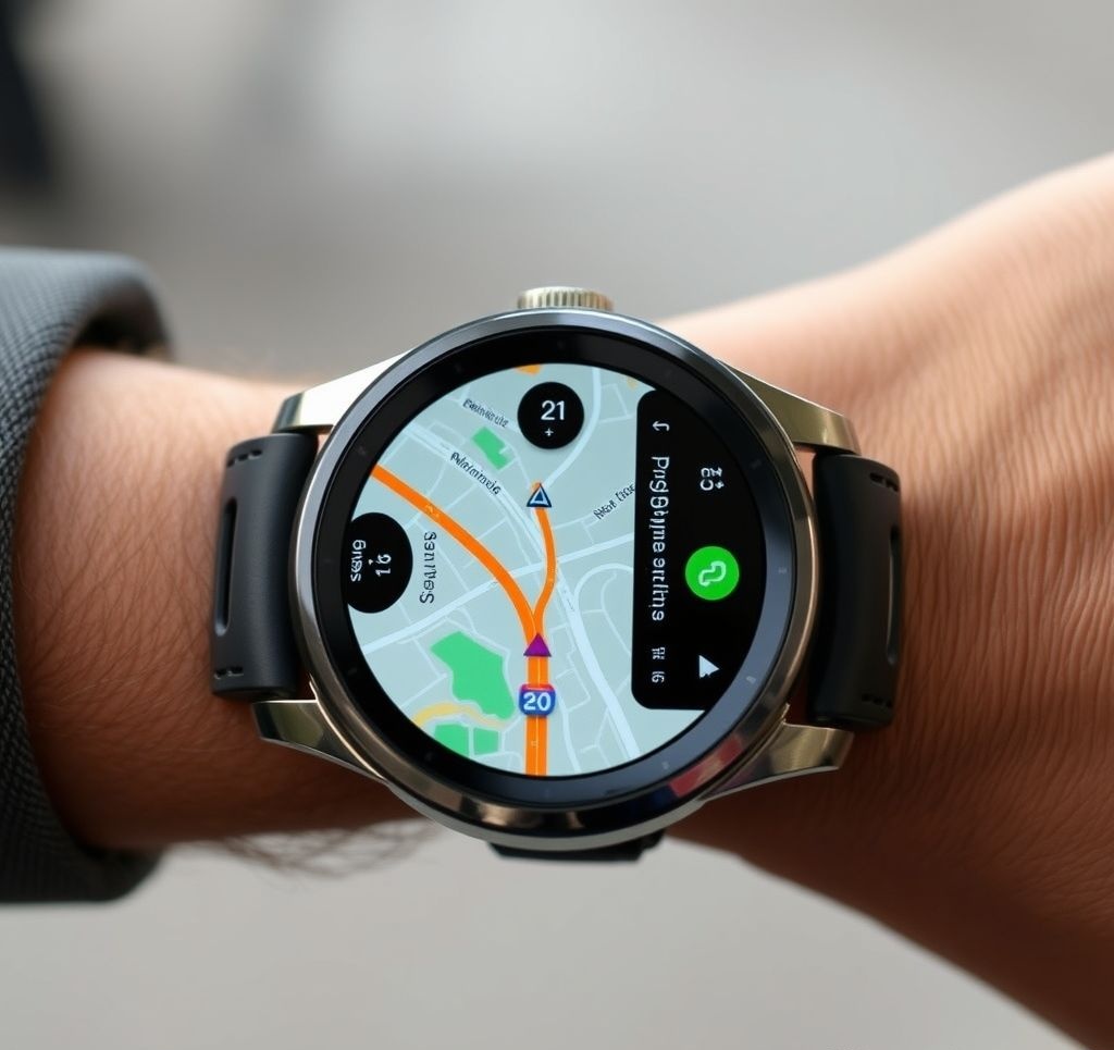
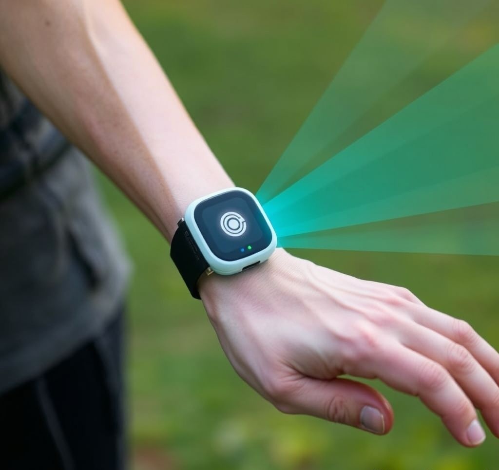
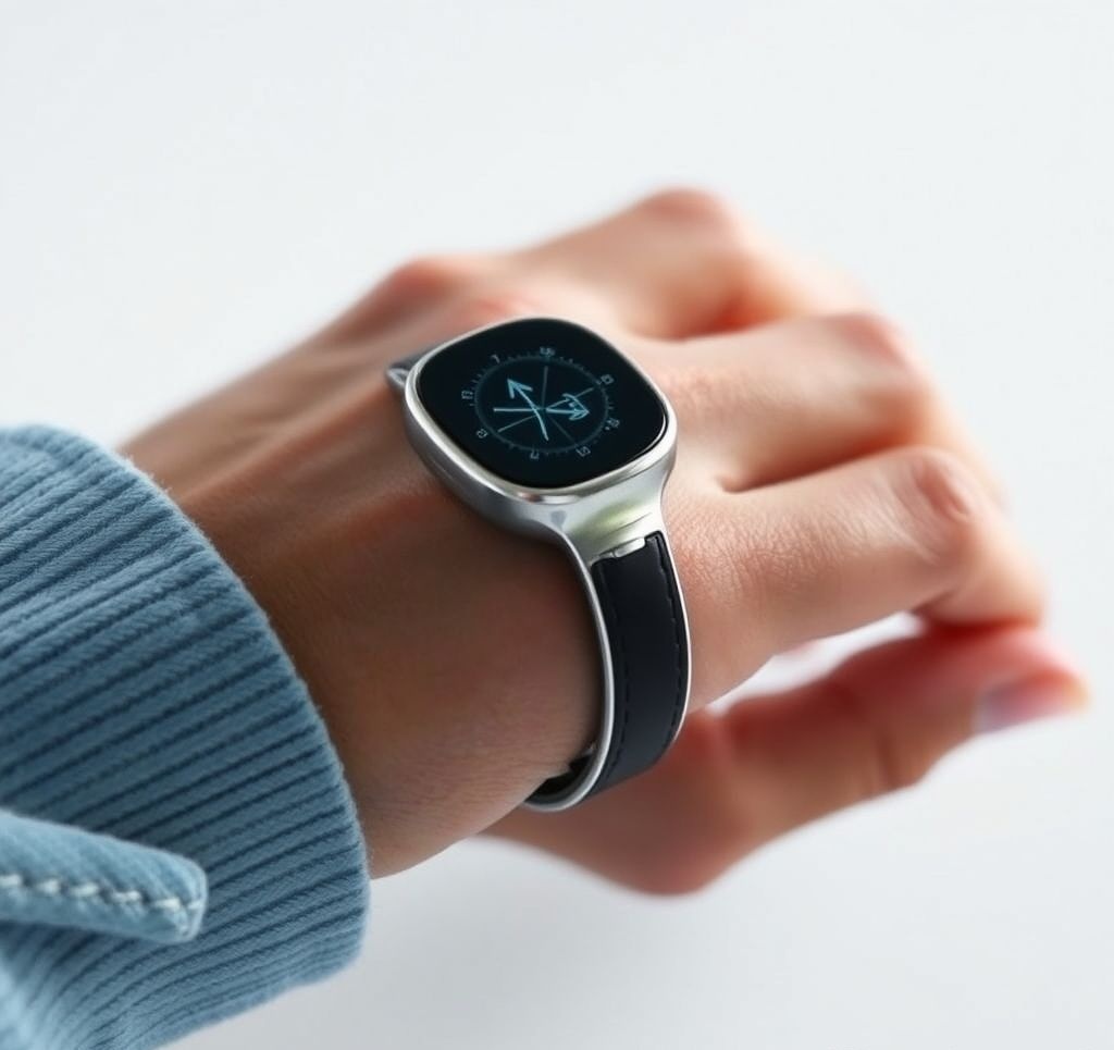
Navigation Smartwatches
Smartwatches represent the most mainstream and widely adopted form of wearable navigation technology. These devices combine the convenience of wrist-worn form factors with increasingly sophisticated navigation capabilities.
Top Navigation Smartwatches of 2025
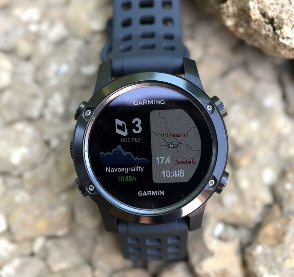
Garmin Fenix 8 Pro Solar
The Garmin Fenix 8 Pro Solar represents the pinnacle of outdoor navigation smartwatches. Building on Garmin's established reputation for reliable GPS technology, this latest model introduces several navigation enhancements including multi-band GNSS support, topographic mapping for over 80 countries, and a revolutionary trail prediction algorithm that adapts to terrain conditions.
Pros
- Exceptional GPS accuracy (±2 meters) even in challenging environments
- Up to 38 days battery life with solar charging in smartwatch mode
- Comprehensive offline mapping with 32GB storage
- TopoActive maps with 3D terrain visualization
- Robust trail routing with elevation profiles
- Supports backtracking and ClimbPro features
Cons
- Premium price point
- Large case size may not suit smaller wrists
- Complex feature set requires learning curve
- Limited urban points-of-interest compared to smartphone apps
Best For: Serious outdoor enthusiasts, hikers, trail runners, and backcountry explorers who need reliable navigation in remote areas.
Standout Navigation Feature: NextFork™ Advanced Trail Guidance
The Fenix 8's proprietary NextFork™ system analyzes upcoming trail junctions using topographic data, satellite imagery, and crowdsourced trail information. It provides detailed visualization of upcoming decision points with 3D terrain rendering, making complex trail intersections easier to navigate even in poor visibility conditions.
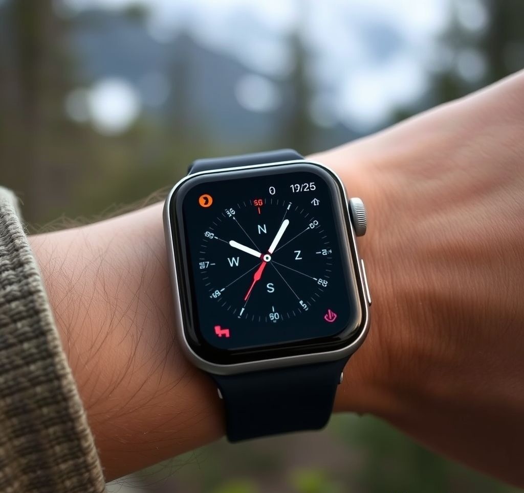
Apple Watch Ultra 2
Apple's premium outdoor smartwatch continues to evolve with the Ultra 2, offering significant improvements in navigation capability. The dual-frequency GPS provides exceptional positioning accuracy, while the redesigned Maps application includes advanced waypoint management and trail routing specifically designed for outdoor activities.
Pros
- Brilliant, highly visible 3000-nit display
- Intuitive interface with Digital Crown and Action Button
- Excellent urban navigation with detailed POI database
- Seamless integration with Apple ecosystem
- Advanced offline mapping capabilities
- Reliable emergency features including satellite SOS
Cons
- Battery life limited to 72 hours in low-power mode
- iOS only, no Android compatibility
- Less robust topo maps compared to dedicated outdoor watches
- Limited customization of navigation data fields
Best For: iPhone users who want a premium smartwatch with robust navigation features for both urban and outdoor environments.
Standout Navigation Feature: Adaptive Navigation Views
The Ultra 2 intelligently switches between navigation display modes based on your activity and environment. In cities, it emphasizes turn-by-turn directions with rich POI data, while automatically transitioning to topographic views with elevation profiles when it detects trail conditions. The system also adjusts information density based on your current pace—showing more details when you're moving slowly and simplifying to essential guidance at higher speeds.
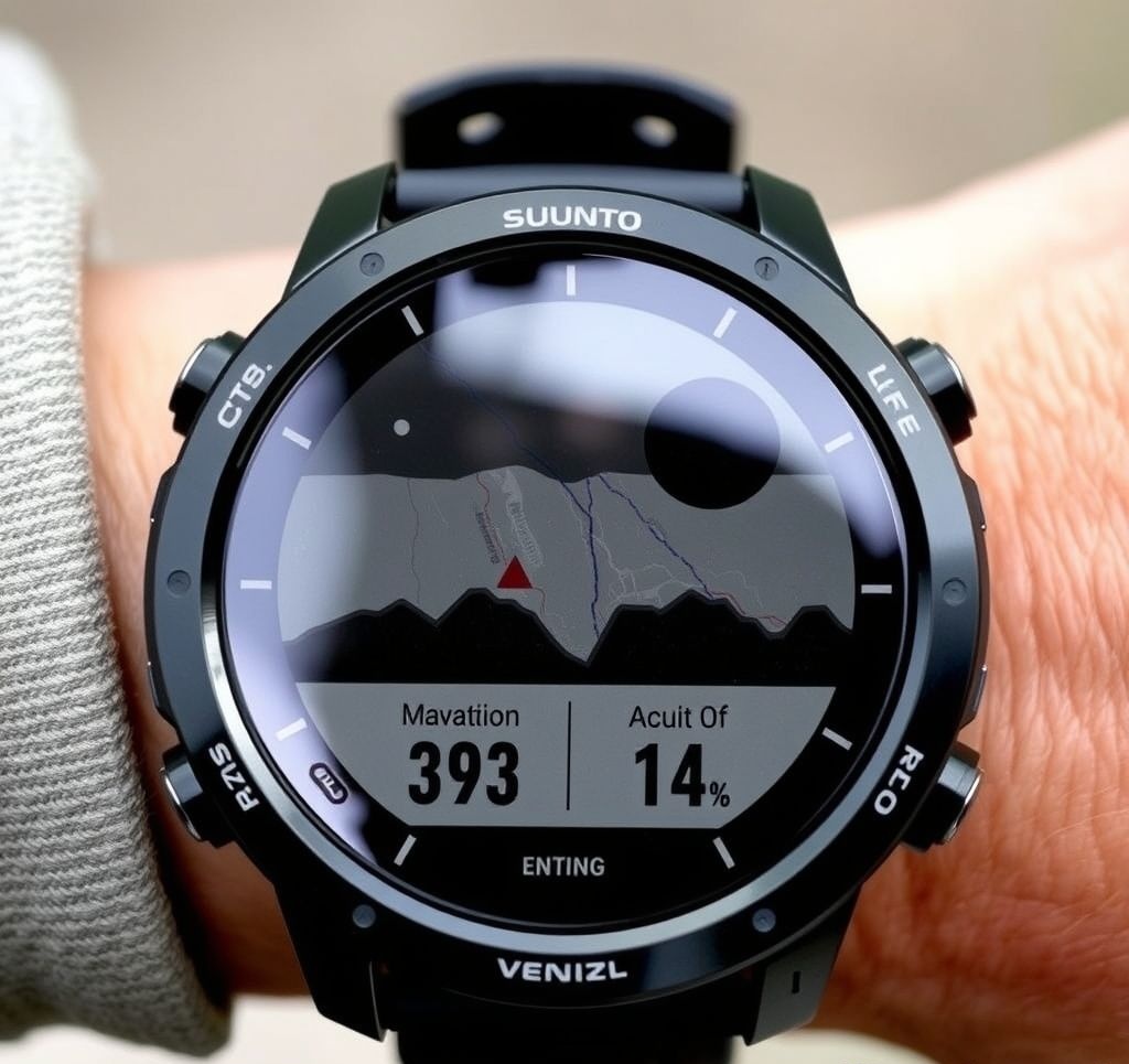
Suunto Vertical Pro
Optimized for vertical sports like climbing, skiing, and mountaineering, the Suunto Vertical Pro offers specialized navigation features for alpine environments. Its 3D terrain rendering and advanced altimetry provide critical situational awareness in mountainous terrain.
Pros
- Industry-leading barometric altimeter accuracy
- Exceptional 3D terrain mapping with route visualization
- Solar charging extends battery to 30 days in watch mode
- Detailed contour maps with slope angle shading
- FusedAlti™ technology combines GPS and barometric data
- Advanced route finding for climbing and skiing
Cons
- Touchscreen less responsive with gloves
- Mobile app experience lags behind competitors
- Limited smartwatch features compared to Apple or Samsung
- Urban navigation capabilities are basic
Best For: Mountaineers, backcountry skiers, and alpine climbers who need specialized vertical navigation and reliable altimetry.
Standout Navigation Feature: 3D Route Terrain Profile
The Vertical Pro renders interactive 3D previews of planned routes, allowing users to explore elevation changes, slope angles, and potential hazards before setting out. This feature is particularly valuable for alpine navigation, where understanding the vertical dimension is as important as the horizontal path. Users can rotate and zoom the 3D view to examine critical sections of their route for better decision-making.
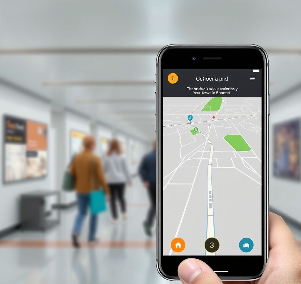
Smartwatch Navigation Software
Beyond the hardware, several specialized navigation applications have emerged for smartwatch platforms. These apps extend the navigation capabilities of compatible smartwatches:
- ViewRanger/Komoot: Offers detailed offline topographic maps and route planning specifically optimized for small screens
- WorkOutDoors: Vector-based mapping application for Apple Watch with comprehensive offline functionality
- Gaia GPS: Robust backcountry navigation with specialized layers like snow coverage and trail descriptions
- AllTrails: Trail-focused navigation with extensive database of user-reviewed routes
- MapMyRun/Strava: Primarily fitness apps with increasingly sophisticated route guidance features
Key Technology: Multi-Band GNSS
The latest premium navigation smartwatches incorporate multi-band GNSS (Global Navigation Satellite System) technology, which simultaneously receives signals across multiple frequency bands from various satellite constellations (GPS, GALILEO, GLONASS, BeiDou). This technology significantly improves positioning accuracy, particularly in challenging environments like dense forests, urban canyons, and deep valleys where traditional GPS may struggle.
Multi-band GNSS provides several key benefits for navigation:
- Better accuracy in suboptimal conditions (from ±10-15m to ±2-3m)
- Reduced susceptibility to atmospheric interference
- Faster position acquisition time
- Improved tracking consistency in motion
The trade-off is increased power consumption, though newer chipsets are becoming more energy-efficient. Expect multi-band GNSS to become standard in mid-range navigation wearables over the next few years as the technology matures.
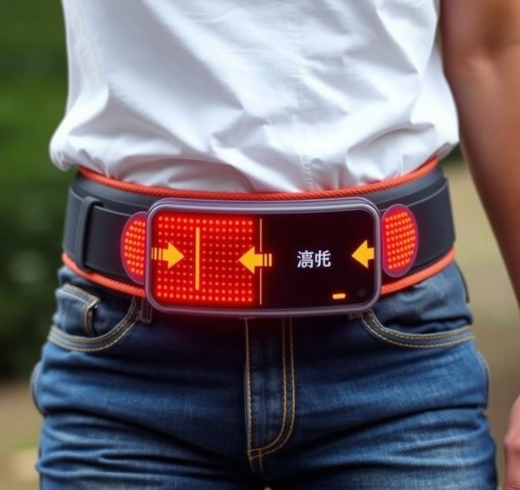
Haptic Navigation Systems
Haptic navigation uses the sense of touch to convey directional information, typically through patterns of vibration. This approach offers several unique advantages, particularly in situations where visual or auditory attention needs to remain focused on the environment.
How Haptic Navigation Works
Most haptic navigation systems use an array of vibrating motors (actuators) positioned around the body. These actuators create patterns that intuitively indicate direction:
- Directional Guidance: Vibration on the left side of a belt signals "turn left," while vibration on the right signals "turn right"
- Intensity Mapping: Stronger vibrations may indicate imminent turns or greater urgency
- Pattern Language: Complex sequences can communicate additional information like distance to next turn or hazards
- Compass Orientation: Some devices maintain continuous awareness of north through persistent gentle vibrations
Haptic navigation uses vibration patterns around the body to indicate direction without visual attention.
Notable Haptic Navigation Devices
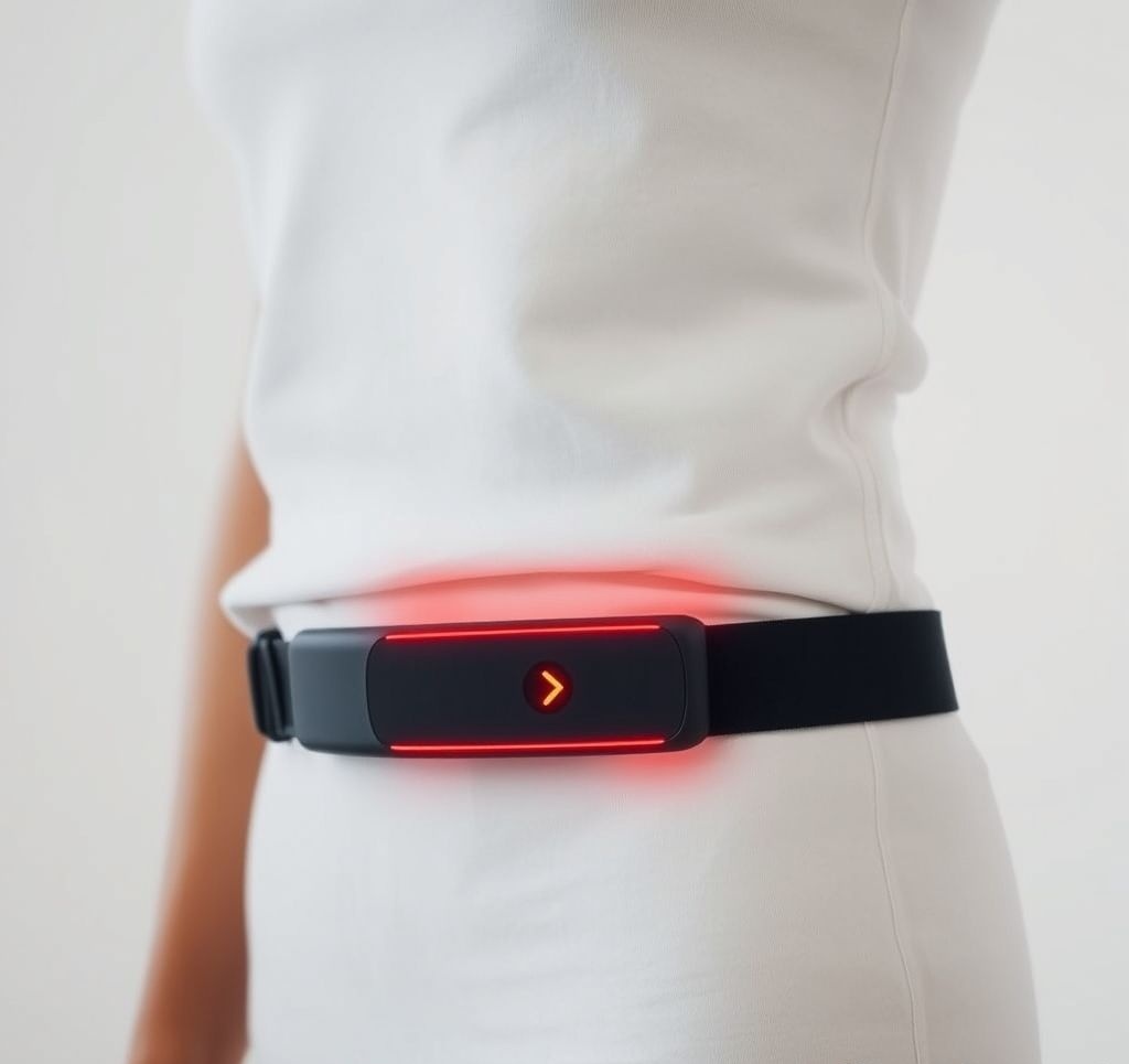
FeelSense Explorer
The FeelSense Explorer represents the newest generation of consumer haptic navigation belts. With 12 precisely positioned vibration motors, it delivers nuanced directional guidance through subtle vibration patterns around the waist.
Pros
- Intuitive directional cues require minimal learning
- 30-hour battery life with quick charging
- Discreet design wears under normal clothing
- Adjustable vibration intensity for different environments
- Water-resistant design handles light rain
- Open API for third-party navigation app integration
Cons
- Requires smartphone connection for GPS positioning
- Limited information complexity compared to visual navigation
- May be less effective over thick winter clothing
- Higher price point than entry-level smartwatches
Best For: Urban explorers, cyclists, and users who want to maintain visual awareness while navigating.
Standout Navigation Feature: Contextual Feedback System
The Explorer adapts its haptic language based on the user's activity and environment. For example, when cycling, it delivers stronger, more pronounced vibrations that can be felt despite road vibration. In pedestrian mode, it uses more subtle cues and incorporates additional patterns to communicate information about points of interest and environmental features.
Neosensory Buzz Pro
Originally developed to help deaf users "feel" sound, the Neosensory Buzz Pro has evolved into a sophisticated wrist-worn haptic navigation device. Using four independently controlled motors, it translates directional information into patterns felt on the wrist.
Pros
- Comfortable, watch-like form factor
- Sophisticated haptic patterns can communicate complex information
- Compatible with major mapping platforms
- Dual functionality as sound awareness device for deaf users
- Machine learning adapts to user's sensitivity preferences
Cons
- Higher learning curve than waist-worn haptic devices
- 8-hour battery life may not last full day of active use
- Limited water resistance (splash-proof only)
- Requires proprietary charging cable
Best For: Urban navigators who want discreet guidance, the hearing-impaired, and those seeking a multifunctional haptic device.
Standout Navigation Feature: Pattern Learning Engine
The Buzz Pro employs machine learning algorithms to optimize its haptic patterns based on individual user response. During the initial setup process and ongoing use, the system learns which vibration patterns are most easily distinguished by each user and adapts accordingly. This personalization significantly improves the intuitive understanding of directional cues, particularly for users with varying levels of tactile sensitivity.
Applications of Haptic Navigation
Haptic navigation technologies are finding use in several specialized applications:
- Visually Impaired Navigation: Providing non-visual directional guidance for blind and low-vision users
- First Responder Operations: Guiding firefighters and rescue personnel in low-visibility environments
- High-Focus Activities: Supporting navigation during activities requiring visual attention elsewhere, like cycling or running
- Military Applications: Enabling silent communication and navigation in tactical scenarios
- Immersive Gaming: Enhancing directional awareness in virtual reality environments
User Experience: Learning Haptic Navigation
Most users report a brief adaptation period when first using haptic navigation systems:
- Initial Phase (1-2 hours): Conscious interpretation of vibration patterns required
- Adaptation Phase (2-7 days): Decreasing cognitive effort needed to interpret cues
- Intuitive Phase (1-2 weeks): Directional information becomes second nature, similar to how we process balance information
Research suggests that haptic directional cues eventually bypass conscious processing, becoming an intuitive sense similar to proprioception—our awareness of body position. This evolution from conscious interpretation to intuitive understanding makes haptic navigation particularly valuable for sustained use.
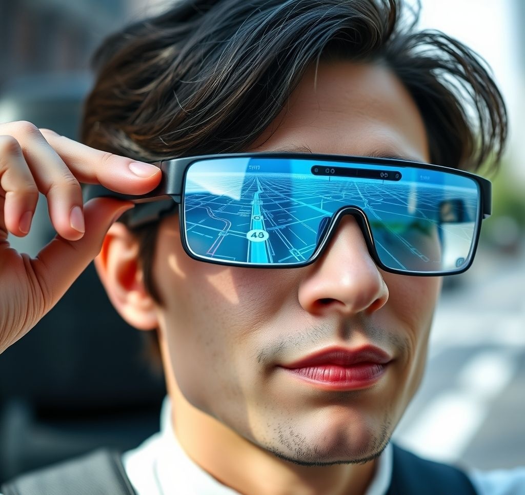
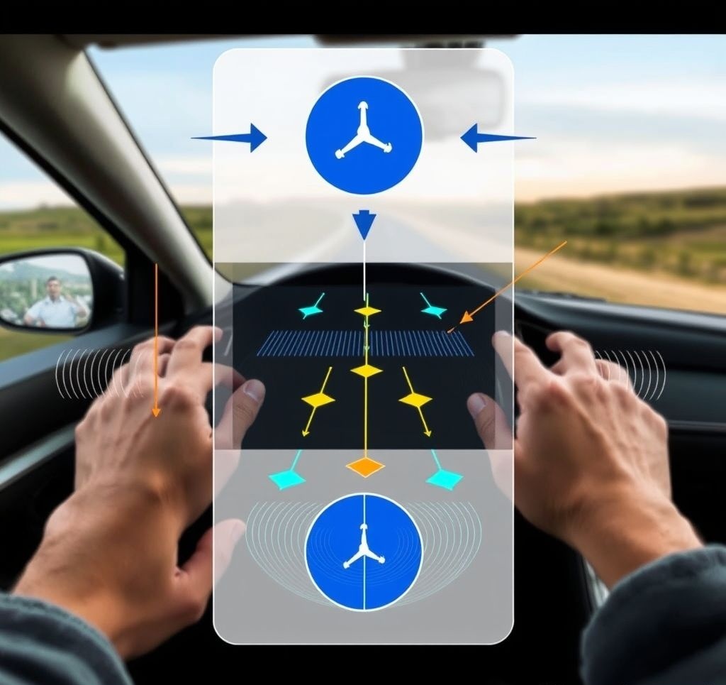
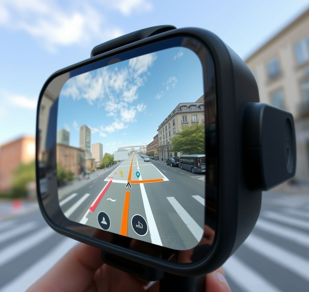
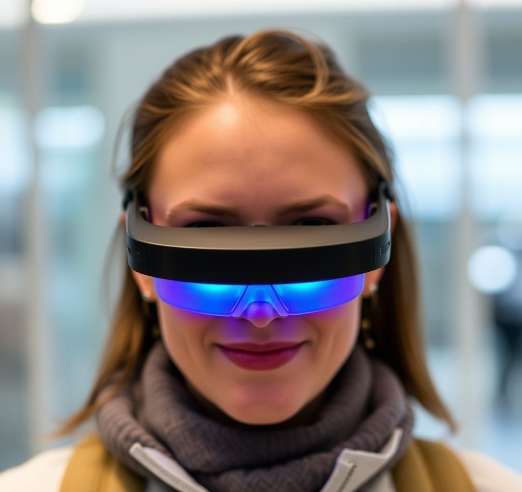
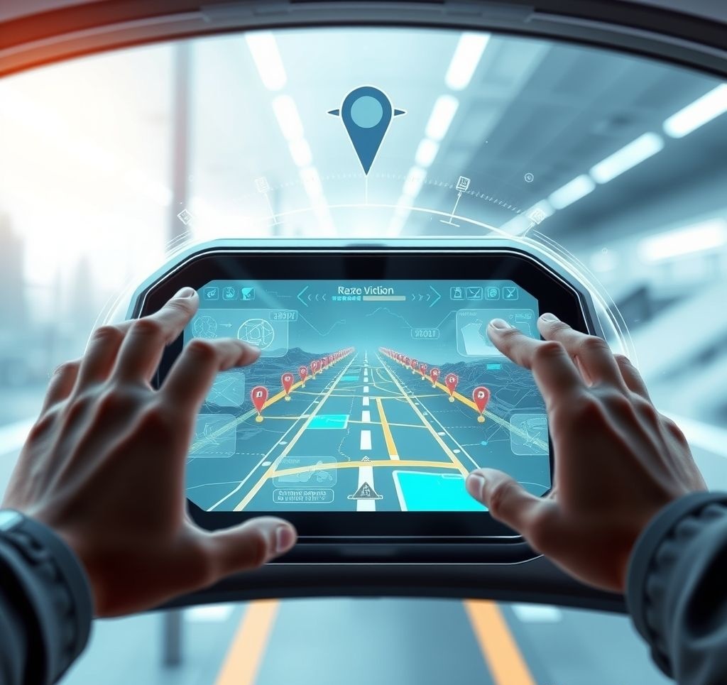
Smart Glasses and AR Navigation
Smart glasses with augmented reality capabilities represent perhaps the most transformative approach to wearable navigation. By overlaying directional guidance directly on your view of the real world, AR navigation creates an intuitive, immersive wayfinding experience.
The AR Navigation Experience
Unlike traditional map-based navigation, AR navigation superimposes directional elements directly onto your view of the physical environment:
- Directional Overlays: Arrows, lines, or paths visually projected onto the real world to indicate turn directions
- Landmark Highlighting: Visual emphasis on buildings, signs, or features that serve as navigation references
- Information Layers: Contextual details about surroundings displayed without looking away from your path
- Distance Indicators: Visual cues showing distance to turns or destinations within your field of view
- Hazard Alerts: Warning indicators for obstacles, elevation changes, or other potential dangers
AR navigation overlays directional guidance directly onto the user's view of the real world.
Leading Smart Glasses with Navigation Features
Apple Vision Pro with MapView AR
While primarily marketed as a mixed reality computing platform, the Apple Vision Pro has evolved into a powerful navigation tool with the addition of the MapView AR navigation application. The system leverages the Vision Pro's high-resolution passthrough cameras and advanced spatial mapping capabilities to create a seamless augmented reality navigation experience.
Pros
- Stunning visual quality with precise AR overlay alignment
- Sophisticated gesture and eye tracking controls
- Seamless integration with Apple Maps data and ecosystem
- Interior navigation for supported venues (malls, airports, etc.)
- Rich contextual information about surroundings
Cons
- Premium price point limits accessibility
- 2-3 hour battery life requires external battery pack for extended use
- Bulky form factor compared to lighter AR glasses
- Limited effectiveness in bright sunlight
Best For: Early adopters and tech enthusiasts who want cutting-edge AR navigation integrated with a comprehensive mixed reality platform.
Standout Navigation Feature: Semantic Landmark Recognition
MapView AR uses computer vision and machine learning to identify and highlight relevant navigation landmarks in real-time. The system understands the semantic significance of environmental features—recognizing, for example, that a distinctive building corner makes a better navigational reference than a generic storefront. This intelligent landmark selection makes directions more natural and human-like, referencing the world as a human guide might ("turn left at the red brick building with the clock tower").

Ray-Ban Meta Navigator
Building on the foundation of their earlier collaboration, Ray-Ban and Meta have created a more navigation-focused smart glasses solution that balances everyday wearability with practical AR navigation features. These glasses project simple directional overlays while maintaining a form factor close to traditional sunglasses.
Pros
- Stylish, conventional eyewear appearance
- Lightweight (48g) for all-day comfort
- 6-hour battery life with navigation active
- Sunglasses-grade UV protection
- Voice control for hands-free operation
- Prescription lens compatibility
Cons
- Limited field of view for AR overlays
- Simplified visuals compared to dedicated AR headsets
- Requires smartphone connection for processing
- Less precise positioning than premium navigation devices
Best For: Style-conscious urban navigators who want subtle AR guidance without the bulk or social awkwardness of larger headsets.
Standout Navigation Feature: Minimalist Directional Interface
Rather than cluttering your field of view with complex visual elements, the Meta Navigator uses a carefully designed minimalist interface that provides just enough information without overwhelming your natural vision. Subtle directional arrows appear only when needed, floating at the periphery of your visual field until approaching decision points. This approach maintains your natural connection to the environment while providing timely guidance.
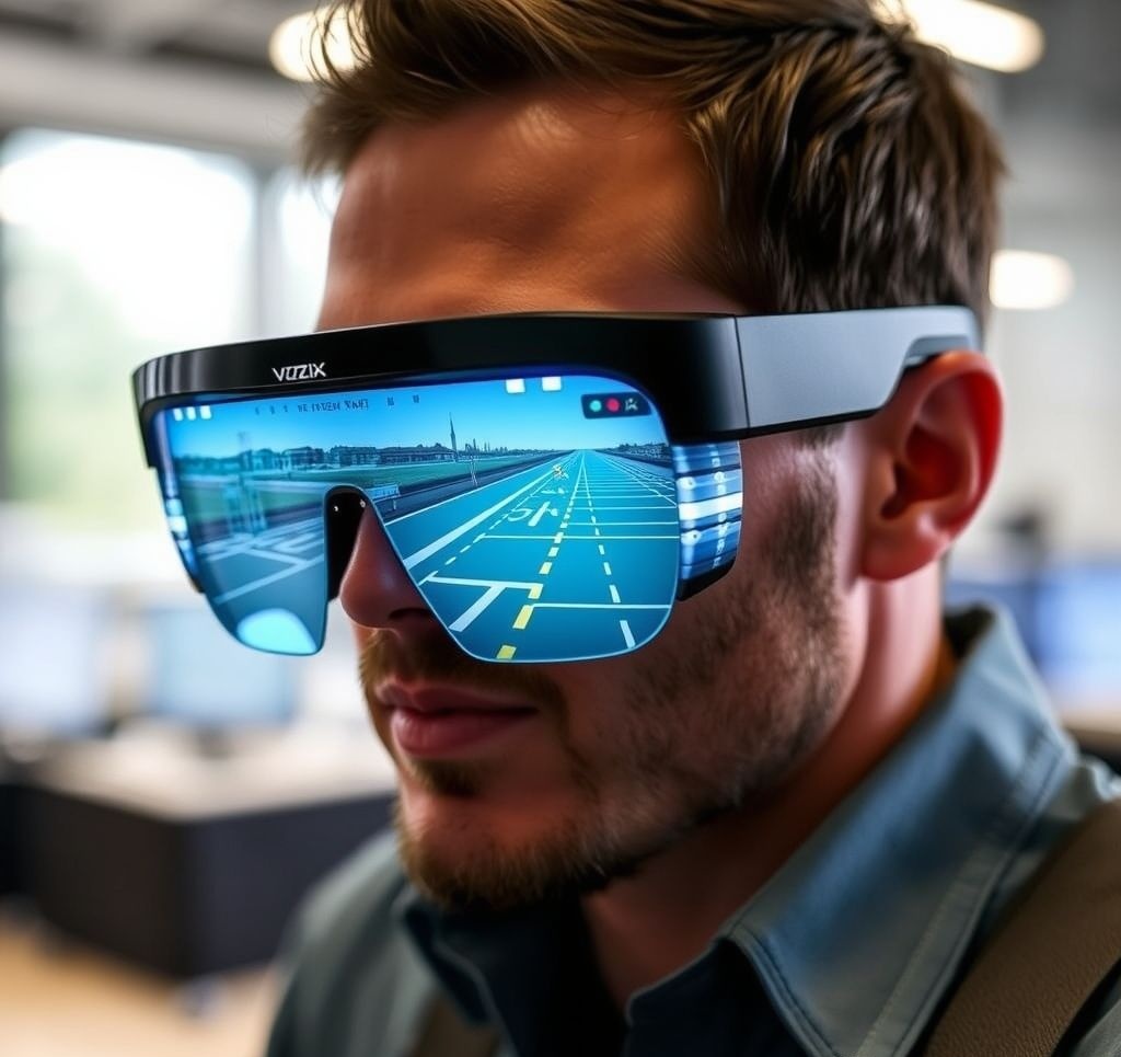
Vuzix Blade Explorer
The Vuzix Blade Explorer represents a more specialized approach to AR navigation, focusing on outdoor recreation and off-trail exploration. These rugged smart glasses combine traditional navigation data with augmented reality to assist in wilderness and backcountry settings.
Pros
- Ruggedized construction with IP67 water/dust resistance
- High-brightness display visible in direct sunlight
- Built-in GPS removes smartphone dependency
- Topographic mapping with terrain visualization
- 8-hour battery life with field-replaceable battery
- Offline functionality for remote areas
Cons
- Utilitarian design sacrifices style for function
- Limited urban navigation features
- Narrower field of view than premium AR headsets
- Heavier than fashion-oriented smart glasses
Best For: Hikers, backcountry explorers, and outdoor enthusiasts who need hands-free navigation in wilderness environments.
Standout Navigation Feature: Terrain Mapping Overlay
The Blade Explorer can superimpose topographic map data directly onto your view of the landscape, helping you identify ridgelines, valleys, and other terrain features that might not be immediately obvious. This capability is particularly valuable in featureless environments like snow-covered landscapes or deserts where traditional landmark navigation becomes challenging. The system can also highlight potential hazards like steep dropoffs or avalanche-prone slopes that might not be visible from your current position.
Challenges and Limitations
Despite their promise, AR navigation glasses face several persistent challenges:
- Battery Life: Powering displays, sensors, and connectivity in a small form factor severely limits operational time
- Daylight Visibility: Many AR displays struggle in bright sunlight, precisely when navigation guidance is often needed
- Form Factor Compromise: Balancing wearability with capability remains challenging
- Social Acceptance: Conspicuous headwear faces adoption barriers in many social contexts
- Positional Accuracy: AR overlays require extremely precise positioning to properly align with the real world
Key Technology: SLAM (Simultaneous Localization and Mapping)
SLAM technology is the foundation of effective AR navigation, allowing devices to simultaneously map their environment while determining their position within it. This computational approach combines data from multiple sensors:
- Visual SLAM: Uses cameras to identify and track visual features in the environment
- LiDAR SLAM: Employs light detection and ranging sensors to create precise 3D maps
- Inertial SLAM: Incorporates motion sensors to track movement between visual observations
By continuously building and refining a spatial map while tracking position within that map, SLAM enables AR overlays to remain precisely aligned with real-world features, even when GPS signals are unavailable or imprecise. As SLAM algorithms become more efficient and hardware more compact, the precision and reliability of AR navigation will continue to improve.
Specialized Navigation Wearables
Beyond the major categories, several innovative specialized wearables have emerged to address particular navigation contexts or user needs:
Navigation Jewelry
Companies like Nimb and Oura have integrated subtle navigation features into wearable jewelry, particularly smart rings. These devices deliver haptic pulses for basic directional guidance without overtly techy aesthetics. The limited interface supports only simple navigation cues, but the discreet form factor enables navigation assistance in formal or fashion-conscious contexts where other wearables might be inappropriate.
Notable product: The Nimb Azimuth Ring ($279) provides turn-by-turn navigation through varied vibration patterns and connects with major mapping services.
Bone Conduction Navigation

Bone conduction headphones transmit sound through the bones of the skull, leaving the ear canal open to hear environmental sounds. This technology has become popular among cyclists, runners, and outdoor enthusiasts who need navigation guidance without sacrificing awareness of traffic or natural sounds. The latest specialized navigation models incorporate directional audio that makes turn instructions seem to come from the direction you need to travel.
Notable product: Shokz OpenMove GPS ($199) combines bone conduction audio with specialized navigation audio processing that creates spatially-aware turn instructions.
Smart Helmets
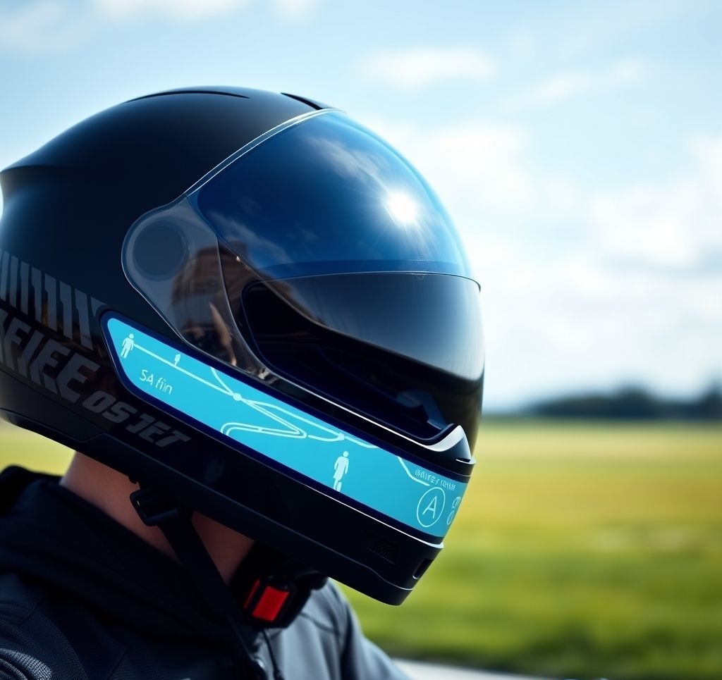
For cyclists and motorcyclists, smart helmets integrate navigation features directly into essential safety equipment. These helmets typically include integrated speakers, heads-up displays projected onto a transparent visor, or LED light arrays that indicate direction. By building navigation into equipment that's already mandatory, these solutions eliminate the need for additional devices.
Notable product: The Lumos Ultra Navigator ($249) features integrated turn signals that sync with navigation apps, automatically activating at appropriate times based on your planned route.
Connected Footwear
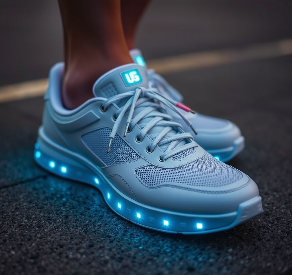
Several companies have embedded navigation technology directly into footwear, using subtle vibrations in the left or right shoe to indicate turn directions. This approach places the haptic feedback at the point of action—your feet—creating an intuitive connection between the guidance and the resulting movement. For pedestrian navigation, this creates a particularly natural interaction model.
Notable product: Lechal Navigator Insoles ($149) can be transferred between different shoes and provide haptic feedback through the soles of your feet, with battery life up to 15 days of typical use.
Tactile Navigation Vests
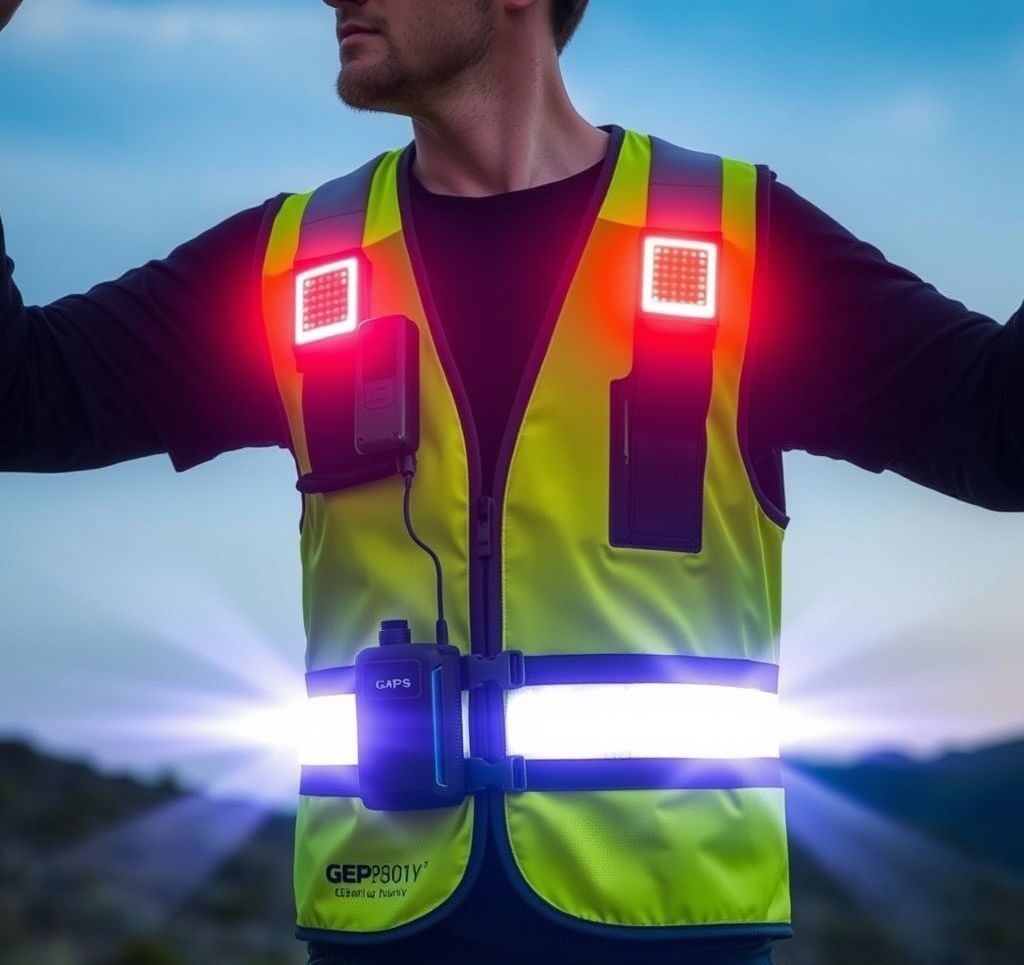
Developed primarily for military, first responder, and industrial applications, tactile navigation vests use arrays of vibration motors distributed across the torso to communicate complex spatial information. These systems can convey more nuanced guidance than simpler haptic devices, including elevation changes, environmental hazards, and team member positions. Some models designed for visually impaired users incorporate additional sensors that detect and communicate overhead obstacles.
Notable product: The Tactile Navigation Tools VestNav Pro ($1,299) features 24 independently controlled haptic motors and integrates with specialized mapping systems for complex environments.
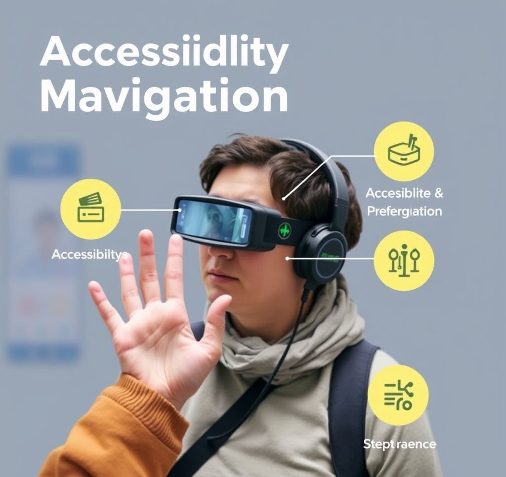
Wearables for Accessibility
Navigation wearables have made particularly significant impact in accessibility applications, creating new possibilities for independent mobility:
Navigation for Visual Impairment
For blind and low-vision individuals, wearable navigation technology offers unprecedented independence:
WeWALK Smart Cane
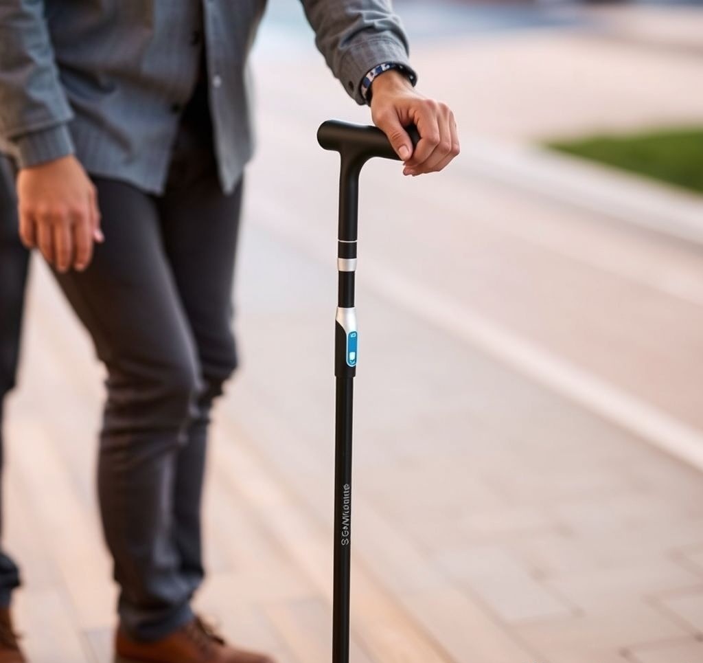
This innovative device integrates navigation technology directly into a white cane. Ultrasonic sensors detect obstacles above chest level (which traditional canes might miss), while haptic feedback in the handle provides turn-by-turn navigation guidance. Paired with a smartphone, the WeWALK can guide users to specific destinations and alert them to nearby points of interest through subtle vibrations and audio cues via bone conduction.
Price: $599
Sunu Band
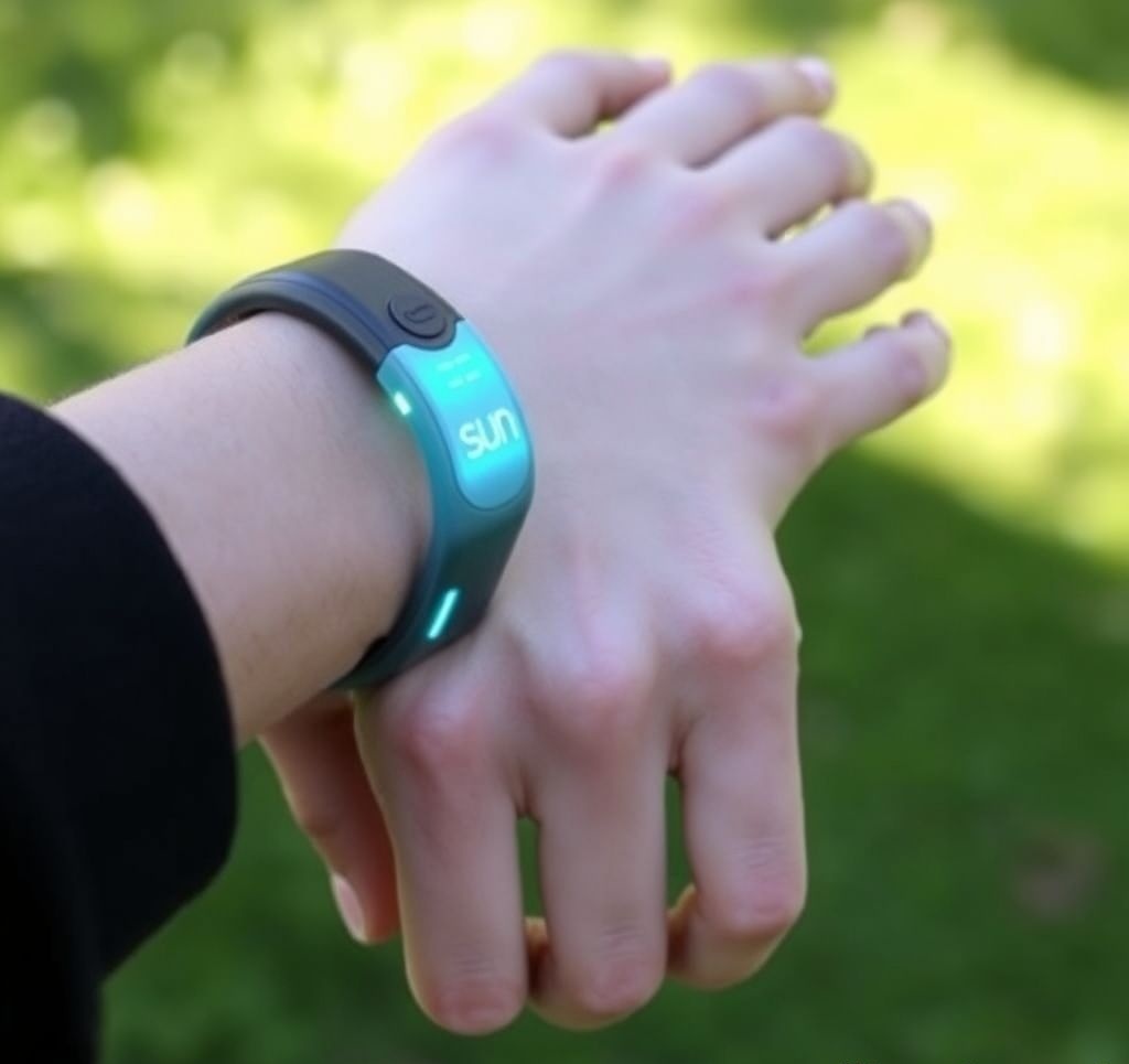
The Sunu Band combines sonar obstacle detection with GPS navigation in a wrist-worn device. The system uses haptic feedback with varying intensities to indicate both navigation directions and the proximity of obstacles. Its "near field" sensing can detect objects up to 16 feet away, complementing the functionality of a cane or guide dog by detecting obstacles at head and upper body height.
Price: $379
Envision Glasses
Built on the Google Glass Enterprise platform, Envision Glasses combine computer vision with AI to provide audio description of surroundings for blind users. The navigation features include verbal description of upcoming turns, recognition and announcement of landmarks, and the ability to read street signs and building numbers. The system can also connect with sighted assistants remotely for additional guidance in complex situations.
Price: $2,499
Navigation for Cognitive Impairments
Individuals with cognitive impairments often face unique navigation challenges that wearables can address:
WayGuide
Designed specifically for users with cognitive disabilities, the WayGuide system combines a simplified smartwatch interface with caregiver management tools. The navigation guidance uses concrete visual references rather than abstract directions ("walk toward the red building" instead of "go north"), and provides reassurance through progress updates. The system includes geofencing features that alert caregivers if the user deviates from expected routes.
Price: $329 plus subscription
NaviLens
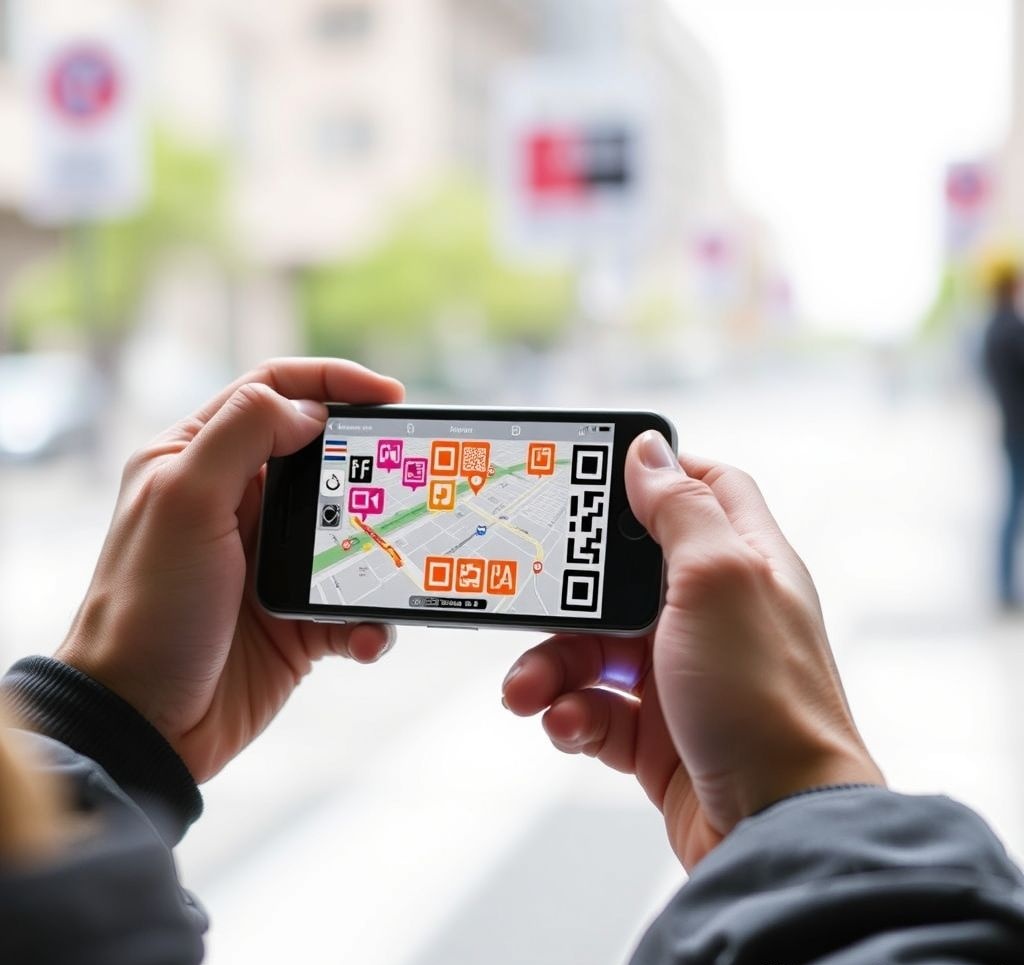
While primarily a smartphone solution rather than a dedicated wearable, NaviLens deserves mention for its innovative approach to cognitive accessibility. The system uses specialized high-contrast markers (similar to QR codes) placed throughout environments like transit stations. These markers can be detected from up to 40 feet away and at angles up to 60 degrees, providing precise location context and navigation guidance through a smartphone app. This approach is particularly valuable for users who might struggle with traditional map interpretation.
Price: Free app with infrastructure investment
Personalization: Key to Accessible Navigation
Research into accessible navigation wearables consistently highlights the importance of personalization. Users with disabilities often develop highly individualized navigation strategies based on their specific capabilities and challenges. The most successful accessibility wearables incorporate adaptive features that adjust to individual preferences:
- Customizable Feedback Intensity: Allowing users to adjust the strength of haptic or audio cues based on their sensory sensitivity
- Information Density Control: Options to increase or decrease the amount of navigational detail provided
- Pace-Based Adaptation: Automatically adjusting guidance timing based on the user's walking speed
- Multiple Feedback Modalities: Providing the same information through different sensory channels (e.g., haptic, audio, and visual)
This emphasis on adaptability ensures that navigation wearables can accommodate the diverse needs and preferences within disability communities, rather than imposing a one-size-fits-all solution.
Future Developments
The field of wearable navigation is evolving rapidly, with several promising technologies on the horizon:
Emerging Technologies
Neural Interfaces
Research into brain-computer interfaces suggests the possibility of delivering navigation information directly to the brain, bypassing traditional sensory channels. Early experiments with devices like Neuralink have demonstrated the potential for "sensory substitution," where directional information can be perceived through artificial neural pathways. While consumer applications remain distant, this approach could eventually enable navigation guidance that feels like an intuitive "sixth sense" rather than external information.
Advanced Haptics
Next-generation haptic technologies will move beyond simple vibration to create more nuanced tactile sensations. Technologies like ultrahaptics (using focused ultrasound to create tactile sensations in mid-air) and electrostatic haptics (creating friction variations on touch surfaces) could enable more information-rich tactile navigation cues without requiring physical contact with actuators.
Smart Textiles
The integration of sensing and feedback capabilities directly into fabrics promises navigation garments that are indistinguishable from conventional clothing. Conductive threads, flexible circuits, and fabric-integrated sensors could transform everyday apparel into navigation interfaces. Early prototypes of directional guidance jackets and shirts demonstrate the potential for truly inconspicuous wearable navigation.
Contact Lens Displays
Companies like Mojo Vision are developing smart contact lenses with integrated micro-displays that could revolutionize AR navigation. These devices would project navigation information directly onto the retina, creating an ultra-discreet augmented reality experience without visible hardware. Technical challenges remain significant, but functional prototypes suggest this technology may be commercially viable within the next decade.
Ambient Navigation
Future systems may move beyond explicit guidance toward ambient navigational awareness. Rather than providing specific turn directions, these technologies would enhance spatial perception more generally, giving users an intuitive sense of orientation and geographic relationships. Early research into devices that provide persistent awareness of north direction or subtle indication of destination location point toward this more integrated approach to navigational assistance.
Integration Trends
Beyond new technologies, several integration trends are shaping the future of wearable navigation:
- Ecosystem Integration: Navigation wearables are increasingly connecting with broader device ecosystems, sharing location data and contextual information across platforms
- Biometric Responsiveness: Next-generation systems will adapt navigation guidance based on physiological status, adjusting route recommendations based on fatigue, stress, or other biometric indicators
- Social Navigation: Wearables that facilitate coordination between groups of users, maintaining awareness of companions' locations and movements in complex environments
- Environmental Sensing: Integration of air quality, noise level, and other environmental data into navigation recommendations for healthier or more pleasant routing
- Predictive Navigation: Using AI to anticipate destinations and provide proactive guidance based on personal patterns and contextual clues
Expert Perspective: Dr. Jennifer Hollingsworth, Wearable Computing Lab
"The most transformative aspect of wearable navigation won't be the technology itself, but rather how it changes our relationship with physical space. As these devices become more integrated with our sensory experience, they'll fundamentally alter how we perceive and understand geography. We're moving toward a future where the distinction between 'knowing where you are' and 'using a navigation tool' begins to blur—navigation becomes less an explicit activity and more an enhanced sense of place."
Ethical and Social Considerations
As wearable navigation technology advances, several important ethical questions are emerging:
- Privacy Implications: Continuous location tracking raises significant data privacy concerns, particularly as systems become more integrated with other personal data
- Dependence and Skill Erosion: Overreliance on navigation technology may lead to atrophy of natural wayfinding abilities and environmental awareness
- Digital Divide: As navigation increasingly depends on advanced wearables, ensuring accessibility across socioeconomic boundaries becomes critical
- Attention Economics: Navigation interfaces compete for limited attentional resources, potentially contributing to cognitive overload
- Public Space Impact: Widespread AR navigation could lead to visual pollution of shared spaces with virtual elements only visible to technology users
Addressing these considerations will be essential for developing wearable navigation technology that enhances human capability and autonomy rather than undermining it.
Buyer's Guide: Choosing the Right Navigation Wearable
With the diversity of wearable navigation options available, selecting the right device depends on your specific needs and preferences:
Key Considerations
Recommendations by User Type
For Casual Urban Navigators
Primary Recommendation: Apple Watch SE or Samsung Galaxy Watch with native navigation apps
Why: These mainstream smartwatches provide reliable urban navigation in a familiar, multi-purpose form factor. Extensive app ecosystems allow customization based on preference, while seamless smartphone integration ensures up-to-date mapping data.
Alternative: Ray-Ban Meta Navigator for those preferring a glasses form factor with subtler guidance.
For Serious Outdoor Enthusiasts
Primary Recommendation: Garmin Fenix 8 Pro Solar or Suunto Vertical Pro
Why: These advanced GPS watches offer exceptional battery life, comprehensive offline mapping, and specialized outdoor navigation features like topographic visualization and altitude profiles. Their rugged construction withstands challenging environments.
Alternative: Vuzix Blade Explorer smart glasses for those who want hands-free visualization of terrain data.
For Cyclists and Urban Commuters
Primary Recommendation: Shokz OpenMove GPS bone conduction headphones
Why: This solution provides clear audio navigation guidance while maintaining environmental awareness for safety. The open-ear design allows you to hear traffic and surroundings while receiving directions.
Alternative: FeelSense Explorer haptic belt for completely silent navigation in urban environments.
For Visually Impaired Users
Primary Recommendation: WeWALK Smart Cane paired with bone conduction headphones
Why: This integrated solution combines essential mobility assistance with accessible navigation guidance. The system detects obstacles while providing clear directional information through both haptic and audio channels.
Alternative: Sunu Band for users who don't regularly use a cane but need navigation assistance.
For Technology Early Adopters
Primary Recommendation: Apple Vision Pro with MapView AR
Why: This cutting-edge mixed reality system offers the most immersive navigation experience currently available to consumers, with precise AR overlays and sophisticated environmental understanding.
Alternative: Advanced haptic systems like the FeelSense Explorer for those interested in exploring novel sensory interfaces.
Conclusion: The Evolving Relationship Between Humans and Navigation
Wearable navigation technology represents a fundamental shift in how we interact with our environments. By integrating directional guidance more seamlessly into our sensory experience, these devices are changing navigation from an explicit activity requiring conscious attention to an augmented sense that operates in the background of awareness.
The diversity of approaches—from subtle haptic cues to immersive augmented reality—demonstrates that there is no single "best" way to deliver navigation information. Instead, the ideal solution depends on individual preferences, specific activities, and particular environments. This personalization will likely increase as technologies mature, with systems adapting their guidance methods to the user's context and needs.
As we look toward future developments, the most exciting possibilities lie not just in technical improvements but in the ways these technologies might enhance our relationship with physical space. By reducing the cognitive burden of basic wayfinding, wearable navigation has the potential to free our attention for deeper engagement with the places we move through—noticing architectural details, appreciating natural features, or simply being more present in the journey rather than focusing solely on the destination.
The revolution in wearable navigation is ultimately about more than getting from point A to point B—it's about transforming the experience of movement through space in ways that enhance human capability while maintaining our fundamental connection to the physical world.

Comments
Leave a Comment
Be the first to comment on this article!