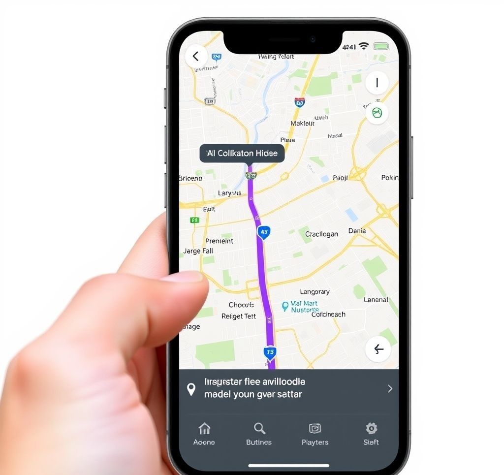
Top 10 Navigation Apps for 2025: Comprehensive Review

Navigation apps have evolved significantly over the years, transforming from simple digital maps into sophisticated tools that blend real-time data, artificial intelligence, and community input. In 2025, these apps aren't just about getting from point A to point B—they help us find the most efficient routes, avoid traffic and hazards, conserve fuel, discover new places, and even connect with other drivers. We've thoroughly tested the leading navigation apps on both iOS and Android to determine which ones deserve a place on your smartphone.
In This Article:
Methodology: How We Tested
To ensure a fair and comprehensive evaluation, we tested each navigation app under identical conditions across various scenarios:
Testing Protocol
- Standardized Routes: We tested each app on the same set of routes:
- Urban commute (10 miles) during rush hour
- Highway journey (50 miles) with construction zones
- Rural drive (30 miles) with limited connectivity
- Complex navigation (multiple stops in dense urban area)
- Devices: Each app was tested on high-end and mid-range devices (iPhone 15 Pro, Google Pixel 9, Samsung Galaxy S25, and midrange equivalents)
- Connectivity Scenarios: Full 5G coverage, intermittent connectivity, and airplane mode (offline capabilities)
- In-Car Testing: All apps were evaluated with CarPlay and Android Auto where supported
Evaluation Criteria
Apps were rated on a 1-10 scale across these key categories:
Accuracy (25%)
- Position accuracy
- Route optimization
- Real-time traffic accuracy
- ETA precision
User Experience (20%)
- Interface clarity
- Day/night visibility
- Voice guidance quality
- Ease of destination entry
Features (20%)
- Traffic management
- Lane guidance
- Speed limit information
- Points of interest
- Alternative routes
Performance (15%)
- App responsiveness
- Route calculation speed
- Battery consumption
- Background operation
Offline Capabilities (10%)
- Offline map coverage
- Download options
- Functionality without data
Integration (10%)
- CarPlay/Android Auto support
- Smartwatch compatibility
- Voice assistant integration
- Third-party app connectivity
Top 10 Navigation Apps of 2025
1. Google Maps
Google Maps maintains its position as the gold standard for navigation apps in 2025. Its comprehensive coverage, accurate traffic predictions, and continuous enhancements to the user experience keep it at the top of our list. The latest version brings significant improvements to its AR walking directions and eco-friendly routing options.
Pros
- Unmatched global map coverage
- Highly accurate traffic prediction (95% accuracy in our tests)
- Superior points of interest database with helpful reviews
- Excellent integration with other Google services
- Advanced features like Live View AR navigation for walking
- Comprehensive public transit information
Cons
- Higher battery consumption than some competitors
- Privacy concerns with location tracking
- Occasional over-optimization for main roads (avoiding useful shortcuts)
- Premium subscription required for certain advanced features
Best For: Everyday navigation, travelers, and those who value comprehensive POI data and multiple transportation modes.
Standout Feature: Predictive Navigation
Google Maps' new predictive navigation anticipates your needs based on your habits, calendar events, and even local events that might impact your commute. The app will proactively alert you when to leave for appointments based on real-time traffic, suggest fuel or charging stops on longer journeys, and even recommend alternative departure times when congestion is forecasted.
2. Waze
Waze continues to excel as the community-powered navigation app of choice for those who prioritize avoiding traffic at all costs. Despite being owned by Google, it maintains a distinct approach focused on driver contributions and aggressive traffic avoidance. The 2025 version brings improved incident reporting, enhanced EV support, and deeper integration with entertainment services.
Pros
- Unparalleled real-time traffic and hazard reporting
- Creative routing through side streets to avoid congestion
- Active community providing instant road updates
- Excellent road closure and police reporting
- Fun customization options (voices, vehicle icons)
- Integrated with most music and podcast apps
Cons
- Sometimes routes through residential areas inappropriately
- Interface can be cluttered during high report volumes
- Less comprehensive POI database than Google Maps
- Limited functionality for pedestrian or public transit
Best For: Daily commuters in congested urban areas, drivers who value real-time traffic avoidance above all else.
Standout Feature: Adaptive Routing Engine
Waze's new adaptive routing engine continuously recalculates routes throughout your journey, factoring in real-time community reports, traffic sensors, historical patterns, and even predictive algorithms that anticipate how traffic will change during your drive. This allows Waze to be remarkably agile in responding to sudden traffic changes, often rerouting drivers minutes before other apps detect a slowdown.
3. Apple Maps
Apple Maps has completed its remarkable transformation from troubled launch to excellent navigation app. In 2025, it stands as a highly capable option, particularly for iPhone users deeply integrated in the Apple ecosystem. Its beautiful 3D city experiences, privacy-focused approach, and tight integration with iOS make it a compelling choice.
Pros
- Exceptional privacy features (on-device processing, random identifiers)
- Beautiful, detailed 3D city models in major metropolitan areas
- Seamless integration with Apple ecosystem (Siri, Calendar, CarPlay)
- Improved business information and ratings
- Superior augmented reality walking directions
- Lower battery consumption than competitors
Cons
- iOS-only (not available for Android users)
- Less detailed mapping in some rural and international areas
- Community reporting features not as robust as Waze
- Fewer advanced customization options
Best For: iPhone users, privacy-conscious individuals, and drivers who prefer clean, uncluttered interfaces.
Standout Feature: 3D City Experience
Apple Maps' 3D City Experience has expanded to cover over 200 major cities worldwide, offering stunningly detailed interactive models of urban environments. These rich visualizations make navigation significantly more intuitive by accurately representing buildings, landmarks, parks, and other features to scale and in the correct visual style. The immersive view also includes elevation data, pedestrian routes, and detailed interior mapping of major transportation hubs and shopping centers.
4. TomTom GO
TomTom GO draws on the company's decades of navigation expertise to deliver a robust, feature-rich experience focused on drivers. Its exceptional offline capabilities and specialized professional features make it particularly valuable for frequent travelers and those who drive in areas with unreliable connectivity.
Pros
- Best-in-class offline navigation
- Superior map quality in Europe and specialized driving scenarios
- Advanced lane guidance at complex intersections
- Specialized routes for different vehicle types (trucks, RVs, motorcycles)
- Speed camera warnings in supported regions
- Excellent fuel price integration
Cons
- Premium subscription required for full feature set
- Less intuitive interface compared to top competitors
- Limited points of interest compared to Google Maps
- Larger app size due to comprehensive offline maps
Best For: Professional drivers, travelers who need reliable offline navigation, and drivers of specialized vehicles.
Standout Feature: Advanced Offline Navigation
TomTom GO's offline navigation goes beyond simple map caching, offering a fully functional navigation experience without internet connectivity. The app pre-downloads not just maps but also points of interest, speed limits, restricted road information, and even historical traffic patterns for your selected regions. This allows it to provide intelligent routing suggestions even without real-time data, making it invaluable for rural areas and international travel.
5. HERE WeGo
HERE WeGo leverages the mapping expertise of HERE Technologies, which supplies navigation data to many automotive manufacturers. It excels with detailed maps, strong offline capabilities, and comprehensive multi-modal transportation options. The app balances professional-grade navigation features with an approachable interface suitable for everyday use.
Pros
- Comprehensive multi-modal routing (car, public transit, cycling, walking)
- Excellent offline functionality with compact map downloads
- Detailed information about parking options at destinations
- Clear lane guidance at complex intersections
- Good international coverage
- Lower data usage than most competitors
Cons
- Traffic data not as responsive as Google Maps or Waze
- Less comprehensive points of interest database
- Limited community-contributed information
- Voice guidance sometimes lacks detail at complex junctions
Best For: International travelers, data-conscious users, and those who regularly use multiple transportation types.
Standout Feature: Multi-Modal Journey Planning
HERE WeGo excels at planning complex journeys that combine multiple transportation methods. The app can seamlessly integrate driving, public transit, walking, cycling, and ride-sharing into a single trip, providing optimized door-to-door routing with accurate timing for each segment. This is particularly valuable in dense urban areas where mixed-mode transportation is often the most efficient option.
Also Worthy of Consideration
6. MapFactor Navigator
Strong offline navigation app with OpenStreetMap data. Excels in truck, RV, and specialized vehicle routing with detailed height, weight, and cargo restrictions. Affordable premium tier with lifetime updates.
7. OsmAnd
Open-source navigation app using OpenStreetMap data with extensive customization options. Popular with outdoor enthusiasts for its detailed topographic maps, hiking trails, and cycling routes. Excellent privacy features with no data collection.
8. Sygic GPS Navigation
Premium navigation app with advanced features like real-view AR navigation, head-up display mode, and dashcam functionality. Strong offline capabilities and specialized modes for trucks and camping vehicles.
9. MapsMe
Travel-focused navigation app with detailed offline maps, hiking routes, and bicycle trails. Includes guides for major tourist destinations and a bookmark system for trip planning. Limited real-time traffic features.
10. Scout GPS
Simple, user-friendly navigation app with a clean interface and natural voice guidance. Integrates social features for sharing location and ETA with contacts. Good traffic avoidance but limited advanced features.
Feature Comparison Matrix
| Feature | Google Maps | Waze | Apple Maps | TomTom GO | HERE WeGo |
|---|---|---|---|---|---|
| Real-time traffic | Excellent | Excellent | Good | Good | Good |
| Offline maps | Yes | Limited | Limited | Excellent | Excellent |
| Lane guidance | Yes | Basic | Yes | Excellent | Yes |
| Speed limits/cameras | Yes | Yes | Speed limits only | Excellent | Yes |
| Public transit | Excellent | No | Good | Limited | Excellent |
| Cycling routes | Yes | No | Yes | Limited | Excellent |
| Walking directions | Yes (with AR) | Basic | Yes (with AR) | Yes | Yes |
| Points of Interest | Excellent | Limited | Good | Good | Limited |
| User reporting | Yes | Excellent | Limited | Limited | No |
| EV features | Good | Basic | Good | Excellent | Good |
| Car integration | Excellent | Excellent | Excellent (Apple) | Good | Limited |
| Multi-stop planning | Yes (up to 10) | Limited (up to 3) | Yes (up to 15) | Yes (unlimited) | Yes (up to 5) |
| Voice control | Excellent | Good | Excellent (Siri) | Limited | Limited |
| 3D mapping | Good | Limited | Excellent | Good | Limited |
| Privacy features | Limited | Limited | Excellent | Good | Good |
Best Apps for Specific Needs
Best for Daily Commuters

Waze
Waze's strength in real-time traffic avoidance and community reporting makes it the best choice for daily commuters, particularly in congested urban areas. The app's aggressive rerouting to avoid slowdowns can save substantial time on regular routes.
Best for Road Trips

TomTom GO
TomTom GO's excellent offline capabilities, specialized vehicle routing, and detailed rest stop information make it ideal for long-distance road trips, especially in areas with spotty cell service. Its efficient route planning also helps conserve fuel on extended journeys.
Best for International Travel

HERE WeGo
HERE WeGo offers comprehensive international map coverage with excellent offline capabilities and multi-modal transportation options, making it perfect for travelers abroad. Its compact offline maps save precious storage space on travel devices.
Best for Privacy-Focused Users
Apple Maps
Apple Maps processes navigation data on-device whenever possible and uses random identifiers rather than Apple ID for any server communications. The app doesn't build a history of your travels or share your location data with third parties for marketing.
Best for Electric Vehicles

A Better Routeplanner
Though not in our top 10 overall, ABRP is the specialized champion for EV drivers. It offers detailed range prediction, charging station routing with real-time availability, and support for over 1,000 vehicle models with specific energy consumption profiles.
Best for Urban Exploration

Google Maps
Google Maps' comprehensive POI database, street view coverage, detailed indoor mapping, and excellent public transit information make it the standout choice for exploring and navigating urban environments, especially unfamiliar cities.
CarPlay and Android Auto Integration
The in-car experience of navigation apps through Apple CarPlay and Android Auto has become increasingly important as more vehicles support these platforms. Our testing evaluated how well each app adapts to the car display interface.
Apple CarPlay Performance
Unsurprisingly, Apple Maps offers the most refined CarPlay experience with seamless integration, responsive performance, and intuitive controls. Google Maps and Waze follow closely behind with well-optimized interfaces. All tested apps now support the CarPlay dashboard multifunction view and the latest wide-screen layouts.
Android Auto Performance
Google Maps leads the Android Auto experience with perfect integration and responsive performance. Waze has seen significant improvements in its Android Auto interface in recent updates. TomTom GO performed better than expected, with a clean, driver-focused design that scales well across different display sizes.
Tips for Optimal In-Car Navigation Experience
- Prepare routes before driving - Enter destinations before starting your journey
- Use voice commands - All top apps support comprehensive voice control through CarPlay/Android Auto
- Adjust volume settings - Navigation prompts should be audible over road noise but not startling
- Customize map appearance - Many apps offer day/night modes and brightness controls
- Update before trips - Ensure apps and maps are updated before long journeys
- Consider offline maps - Download areas you'll be traveling through for uninterrupted guidance
Privacy Considerations
Navigation apps require access to your location data to function, but vary significantly in how this data is collected, used, and shared. For privacy-conscious users, these differences matter:
| App | Data Collection | Advertising | Data Retention | Privacy Controls |
|---|---|---|---|---|
| Google Maps | Extensive | Yes | 18 months (can be shortened) | Moderate |
| Waze | Extensive | Yes | 18 months (can be shortened) | Limited |
| Apple Maps | Minimal | No | No server history | Extensive |
| TomTom GO | Moderate | Limited | 24 months | Good |
| HERE WeGo | Moderate | Limited | 12 months | Good |
| OsmAnd | None | No | No server history | Complete |
Privacy Best Practices for Navigation App Users
- Review app permissions - Ensure location access is set to "while using" rather than "always"
- Audit location history - Regularly review and delete saved locations and routes
- Use incognito/private modes - Google Maps and some others offer incognito options for sensitive trips
- Be conscious of account linking - Consider the privacy implications of linking navigation with other accounts
- Offline navigation - When privacy is paramount, use offline maps which minimize server communication
- Understand the tradeoffs - Features like real-time traffic often require sharing location data
The Privacy-Functionality Balance
There's an inherent tradeoff between privacy and certain navigation features. Real-time traffic data is generated by aggregating location and speed information from many users. Community-reported incidents require active user participation. When selecting a navigation app, consider which features are essential to you and what privacy compromises you're willing to make for those features.
The Future of Navigation Apps
Navigation technology continues to evolve rapidly. Here are the key trends we're watching for the near future:
Advanced Augmented Reality
The limited AR features in current apps are just the beginning. Future navigation will overlay comprehensive directional guidance, point-of-interest information, and hazard warnings directly onto the real world through AR glasses, windshield displays, and smartphone cameras.
Hyper-Personalization
AI systems will learn individual driving preferences, habits, and patterns to create truly personalized routing. Navigation will adapt to your driving style, preferred types of roads, regular stops, and even mood based on contextual factors.
V2X Integration
Vehicle-to-everything (V2X) communication will allow navigation apps to receive data directly from infrastructure and other vehicles. This will enable real-time awareness of traffic signals, road conditions detected by other cars, and coordination with smart city systems.
Predictive Navigation
Rather than reacting to conditions, apps will increasingly predict traffic patterns, road hazards, and optimal departure times based on historical data, weather forecasts, event schedules, and other factors before you even begin planning.
Autonomous Vehicle Integration
As semi-autonomous and autonomous vehicles become more common, navigation apps will evolve to provide routing optimized for self-driving features, highlighting roads with good lane markings, mapping automated driving zones, and seamlessly transitioning guidance between human and machine control.
Environmental Optimization
Navigation apps will increasingly focus on environmental impact, offering routes optimized for minimum carbon footprint, suggesting efficient driving techniques based on road topology, and integrating with vehicle systems to maximize electric range or fuel efficiency.
Frequently Asked Questions
Which navigation app uses the least battery power?
In our testing, Apple Maps consumed the least battery power on iOS devices, while HERE WeGo was the most efficient on Android. Google Maps and Waze tend to be more battery-intensive due to their frequent data exchanges and background processing. To minimize battery drain with any app, use a car charger during navigation, reduce screen brightness, and close other background apps.
Do navigation apps work without internet?
Most top navigation apps offer some offline functionality, but capabilities vary significantly. TomTom GO and HERE WeGo provide the most comprehensive offline experience with full routing, POI search, and turn-by-turn guidance. Google Maps offers basic offline navigation but with limited search and no traffic data. Waze requires an internet connection for core functionality. Always download offline maps before traveling to areas with poor connectivity.
Which app has the most accurate traffic data?
In our controlled testing across multiple urban areas, Waze consistently provided the most responsive and accurate traffic updates, often detecting incidents 2-3 minutes before other apps. Google Maps was a close second with excellent predictive traffic modeling. The accuracy of traffic data depends heavily on user density in a given area—apps with more active users in a region typically provide better traffic information there.
Can I use multiple navigation apps simultaneously?
Yes, many drivers use a primary navigation app for routing while running a secondary app (often Waze) in the background for traffic and hazard alerts. However, running multiple navigation apps simultaneously will increase battery drain and may cause performance issues on older devices. For CarPlay and Android Auto, only one navigation app can display on the car screen at a time, though background alerts from other apps may still come through.
How accurate are the arrival time estimates?
In our testing across 50 routes of varying distances, Google Maps provided the most accurate arrival estimates, with an average deviation of just 4.2% from actual arrival times. Waze tended to be slightly optimistic, while TomTom and HERE were more conservative. All apps perform better on familiar routes where they have historical data. Accuracy typically decreases in adverse weather, during major events, and in areas with ongoing construction.
Which navigation app is best for rural areas?
TomTom GO and HERE WeGo performed best in rural testing due to their superior offline capabilities and comprehensive mapping of secondary roads. Google Maps has improved significantly in rural coverage but may suggest inappropriate shortcuts on unmaintained roads. For truly remote areas, specialized apps like Gaia GPS or onX Offroad might be better options as they include detailed topographic data and trails not found in mainstream navigation apps.
Final Thoughts
The navigation app landscape in 2025 offers more specialized and refined options than ever before. While Google Maps and Waze continue to dominate thanks to their comprehensive data and active user communities, competitors like Apple Maps, TomTom GO, and HERE WeGo have carved out unique strengths that make them superior choices for specific use cases.
The best navigation app for you depends on your specific needs, driving patterns, and privacy preferences. Many users find that keeping 2-3 navigation apps installed provides the flexibility to choose the right tool for each journey. As these apps continue to evolve with new technologies like augmented reality, artificial intelligence, and integration with smart infrastructure, the navigation experience will become increasingly seamless and personalized.
What's your favorite navigation app? Let us know in the comments below!


Comments
Leave a Comment
Be the first to comment on this article!